!pip install -q pystac-client stac-geoparquet pyarrow mlcroissant rasterio
[notice] A new release of pip is available: 26.0 -> 26.0.1
[notice] To update, run: pip install --upgrade pip
In this notebook, we download NAIP STAC items, convert them to GeoParquet using stac-geoparquet, and then programmatically generate a MLCommons GeoCroissant metadata.
!pip install -q pystac-client stac-geoparquet pyarrow mlcroissant rasterio
[notice] A new release of pip is available: 26.0 -> 26.0.1
[notice] To update, run: pip install --upgrade pipimport json
from pathlib import Path
import pystac_client
max_items = 100
naip_json_path = Path("naip.jsonl")
if naip_json_path.exists():
print(f"Using existing {naip_json_path}")
else:
catalog = pystac_client.Client.open("https://planetarycomputer.microsoft.com/api/stac/v1")
items_iter = catalog.get_collection("naip").get_items()
with open(naip_json_path, "w") as f:
count = 0
for item in items_iter:
json.dump(item.to_dict(), f, separators=(",", ":"))
f.write("\n")
count += 1
if count >= max_items:
break
print(f"Downloaded {max_items} STAC items to {naip_json_path}")Downloaded 100 STAC items to naip.jsonlimport stac_geoparquet.arrow
import pyarrow.parquet as pq
naip_parquet_path = "naip.parquet"
stac_geoparquet.arrow.parse_stac_ndjson_to_parquet(naip_json_path, naip_parquet_path)
print(f"Saved GeoParquet to {naip_parquet_path}")
table = pq.read_table(naip_parquet_path)
print("GeoParquet Schema:")
print(table.schema)Saved GeoParquet to naip.parquet
GeoParquet Schema:
assets: struct<image: struct<eo:bands: list<element: struct<common_name: string, description: string, name: (... 378 chars omitted)
child 0, image: struct<eo:bands: list<element: struct<common_name: string, description: string, name: string>>, href (... 68 chars omitted)
child 0, eo:bands: list<element: struct<common_name: string, description: string, name: string>>
child 0, element: struct<common_name: string, description: string, name: string>
child 0, common_name: string
child 1, description: string
child 2, name: string
child 1, href: string
child 2, roles: list<element: string>
child 0, element: string
child 3, title: string
child 4, type: string
child 1, rendered_preview: struct<href: string, rel: string, roles: list<element: string>, title: string, type: string>
child 0, href: string
child 1, rel: string
child 2, roles: list<element: string>
child 0, element: string
child 3, title: string
child 4, type: string
child 2, thumbnail: struct<href: string, roles: list<element: string>, title: string, type: string>
child 0, href: string
child 1, roles: list<element: string>
child 0, element: string
child 2, title: string
child 3, type: string
child 3, tilejson: struct<href: string, roles: list<element: string>, title: string, type: string>
child 0, href: string
child 1, roles: list<element: string>
child 0, element: string
child 2, title: string
child 3, type: string
bbox: struct<xmin: double, ymin: double, xmax: double, ymax: double>
child 0, xmin: double
child 1, ymin: double
child 2, xmax: double
child 3, ymax: double
collection: string
geometry: binary
-- field metadata --
ARROW:extension:name: 'geoarrow.wkb'
ARROW:extension:metadata: '{"crs":{"$schema":"https://proj.org/schemas/' + 1380
id: string
links: list<element: struct<href: string, rel: string, title: string, type: string>>
child 0, element: struct<href: string, rel: string, title: string, type: string>
child 0, href: string
child 1, rel: string
child 2, title: string
child 3, type: string
stac_extensions: list<element: string>
child 0, element: string
stac_version: string
type: string
datetime: timestamp[us, tz=UTC]
gsd: double
naip:state: string
naip:year: string
proj:bbox: list<element: double>
child 0, element: double
proj:centroid: struct<lat: double, lon: double>
child 0, lat: double
child 1, lon: double
proj:code: string
proj:shape: list<element: int64>
child 0, element: int64
proj:transform: list<element: double>
child 0, element: double
providers: list<element: struct<name: string, roles: list<element: string>, url: string>>
child 0, element: struct<name: string, roles: list<element: string>, url: string>
child 0, name: string
child 1, roles: list<element: string>
child 0, element: string
child 2, url: string
-- schema metadata --
geo: '{"version": "1.1.0", "columns": {"geometry": {"encoding": "WKB", "g' + 1740
stac-geoparquet: '{"version": "1.0.0"}'We map the Parquet schema to GeoCroissant semantics by extracting bounding boxes and time ranges dynamically.
import pyarrow.compute as pc
import pyarrow.parquet as pq
import json, datetime

# Temporal coverage
min_dt = pc.min(table["datetime"]).as_py()
max_dt = pc.max(table["datetime"]).as_py()
temporal_coverage = f"{min_dt.strftime('%Y-%m-%d')}/{max_dt.strftime('%Y-%m-%d')}"

# Spatial bounding box (minY minX maxY maxX)
min_x = pc.min(pc.struct_field(table["bbox"], [0])).as_py()
min_y = pc.min(pc.struct_field(table["bbox"], [1])).as_py()
max_x = pc.max(pc.struct_field(table["bbox"], [2])).as_py()
max_y = pc.max(pc.struct_field(table["bbox"], [3])).as_py()
spatial_box = f"{min_y} {min_x} {max_y} {max_x}"

# Collection name & URLs from parquet
collection_name = table["collection"][0].as_py() if "collection" in table.schema.names else "unknown"
dataset_name = f"{collection_name}_geoparquet"

collection_url = ""
if "links" in table.schema.names:
    for link in (table["links"][0].as_py() or []):
        if isinstance(link, dict) and link.get("rel") == "collection":
            collection_url = link.get("href", "")
            break

# Spatial resolution from gsd column
gsd_value = None
if "gsd" in table.schema.names:
    gsd_value = round(float(pc.approximate_median(table["gsd"]).as_py()), 3)

# Native CRS from GeoParquet file metadata
crs_str = "EPSG:4326"
geo_meta_raw = pq.read_metadata(naip_parquet_path).metadata.get(b"geo")
if geo_meta_raw:
    geo_meta = json.loads(geo_meta_raw)
    crs_obj = geo_meta.get("columns", {}).get("geometry", {}).get("crs")
    if isinstance(crs_obj, dict):
        crs_id = crs_obj.get("id", {})
        crs_str = f"{crs_id.get('authority', 'EPSG')}:{crs_id.get('code', 4326)}"
    elif isinstance(crs_obj, str):
        crs_str = crs_obj

# Providers & license from parquet
license_str = "Unknown"
creators = []
if "providers" in table.schema.names:
    for p in (table["providers"][0].as_py() or []):
        if not isinstance(p, dict):
            continue
        roles = p.get("roles", [])
        if "licensor" in roles:
            license_str = p.get("url", "Unknown")
        if any(r in roles for r in ("producer", "licensor", "host")):
            creators.append({"@type": "Organization", "name": p.get("name", ""), "url": p.get("url", "")})

# Spectral bands from eo:bands inside assets
_wl_lookup = {
    "red":    {"center": 660,  "bw": 60},
    "green":  {"center": 560,  "bw": 80},
    "blue":   {"center": 470,  "bw": 100},
    "nir":    {"center": 825,  "bw": 150},
    "swir16": {"center": 1610, "bw": 90},
    "swir22": {"center": 2200, "bw": 180},
}
spectral_bands = []
band_names = []
try:
    first_row = table.slice(0, 1).to_pydict()
    assets = (first_row.get("assets") or [{}])[0] or {}
    image_asset = assets.get("image") or {}
    for b in (image_asset.get("eo:bands") or []):
        name = b.get("name") or b.get("common_name", "Unknown")
        common = (b.get("common_name") or "").lower()
        entry = {"@type": "geocr:SpectralBand", "name": name}
        if common in _wl_lookup:
            wl = _wl_lookup[common]
            entry["geocr:centerWavelength"] = {"@type": "QuantitativeValue", "value": wl["center"], "unitText": "nm"}
            entry["geocr:bandwidth"]        = {"@type": "QuantitativeValue", "value": wl["bw"],     "unitText": "nm"}
        spectral_bands.append(entry)
        band_names.append(name)
except Exception as e:
    print(f"Warning: could not extract eo:bands: {e}")

print(f"Collection     : {collection_name}")
print(f"Dataset URL    : {collection_url}")
print(f"GSD            : {gsd_value} m")
print(f"CRS            : {crs_str}")
print(f"License        : {license_str}")
print(f"Bands          : {band_names}")
print(f"Temporal       : {temporal_coverage}")
print(f"Spatial box    : {spatial_box}")
Collection : naip
Dataset URL : https://planetarycomputer.microsoft.com/api/stac/v1/collections/naip
GSD : 0.6 m
CRS : EPSG:4326
License : https://www.fsa.usda.gov/programs-and-services/aerial-photography/imagery-programs/naip-imagery/
Bands : ['Red', 'Green', 'Blue', 'NIR']
Temporal : 2023-11-17/2023-11-17
Spatial box : 45.059225 -116.066472 49.065003 -113.182469Here we assign the table as the Distribution and define fields mapped to the Parquet columns.
import hashlib, datetime

# Compute sha256 of the parquet file
sha256_hash = hashlib.sha256()
with open(naip_parquet_path, "rb") as f:
    for chunk in iter(lambda: f.read(8192), b""):
        sha256_hash.update(chunk)
parquet_sha256 = sha256_hash.hexdigest()
print(f"SHA256: {parquet_sha256}")

CONTEXT = {
    "@language": "en",
    "@vocab": "https://schema.org/",
    "citeAs": "cr:citeAs",
    "column": "cr:column",
    "conformsTo": "dct:conformsTo",
    "cr": "http://mlcommons.org/croissant/",
    "geocr": "http://mlcommons.org/croissant/geo/",
    "rai": "http://mlcommons.org/croissant/RAI/",
    "dct": "http://purl.org/dc/terms/",
    "sc": "https://schema.org/",
    "data": {"@id": "cr:data", "@type": "@json"},
    "examples": {"@id": "cr:examples", "@type": "@json"},
    "dataBiases": "cr:dataBiases",
    "dataCollection": "cr:dataCollection",
    "dataType": {"@id": "cr:dataType", "@type": "@vocab"},
    "extract": "cr:extract",
    "field": "cr:field",
    "fileProperty": "cr:fileProperty",
    "fileObject": "cr:fileObject",
    "fileSet": "cr:fileSet",
    "format": "cr:format",
    "includes": "cr:includes",
    "isLiveDataset": "cr:isLiveDataset",
    "jsonPath": "cr:jsonPath",
    "key": "cr:key",
    "md5": "cr:md5",
    "equivalentProperty": "cr:equivalentProperty",
    "parentField": "cr:parentField",
    "path": "cr:path",
    "personalSensitiveInformation": "cr:personalSensitiveInformation",
    "recordSet": "cr:recordSet",
    "references": "cr:references",
    "regex": "cr:regex",
    "repeated": "cr:repeated",
    "replace": "cr:replace",
    "samplingRate": "cr:samplingRate",
    "separator": "cr:separator",
    "source": "cr:source",
    "subField": "cr:subField",
    "transform": "cr:transform",
}

from pathlib import Path

parquet_filename = Path(naip_parquet_path).name

# Build fields list from parquet schema
parquet_fields = [
    {"@type": "cr:Field", "@id": f"{collection_name}_items/id",
     "name": f"{collection_name}_items/id", "dataType": "sc:Text",
     "source": {"fileObject": {"@id": parquet_filename}, "extract": {"column": "id"}}},
    {"@type": "cr:Field", "@id": f"{collection_name}_items/geometry",
     "name": f"{collection_name}_items/geometry",
     "description": "WKB binary of the item geometry",
     "dataType": "sc:Text",
     "source": {"fileObject": {"@id": parquet_filename}, "extract": {"column": "geometry"}}},
    {"@type": "cr:Field", "@id": f"{collection_name}_items/image_url",
     "name": f"{collection_name}_items/image_url", "dataType": "sc:URL",
     "source": {"fileObject": {"@id": parquet_filename}, "extract": {"column": "assets"}, "transform": {"jsonPath": "$.image.href"}},
     "geocr:bandConfiguration": {
         "@type": "geocr:BandConfiguration",
         "geocr:totalBands": len(band_names),
         "geocr:bandNameList": band_names,
     }},
    {"@type": "cr:Field", "@id": f"{collection_name}_items/datetime",
     "name": f"{collection_name}_items/datetime",
     "description": "Acquisition datetime (UTC ms epoch)",
     "dataType": "sc:DateTime",
     "source": {"fileObject": {"@id": parquet_filename}, "extract": {"column": "datetime"}}},
    {"@type": "cr:Field", "@id": f"{collection_name}_items/gsd",
     "name": f"{collection_name}_items/gsd",
     "description": "Ground sample distance in metres",
     "dataType": "sc:Float",
     "source": {"fileObject": {"@id": parquet_filename}, "extract": {"column": "gsd"}}},
    {"@type": "cr:Field", "@id": f"{collection_name}_items/proj_code",
     "name": f"{collection_name}_items/proj_code",
     "description": "Native projected CRS of the imagery tile",
     "dataType": "sc:Text",
     "source": {"fileObject": {"@id": parquet_filename}, "extract": {"column": "proj:code"}}},
    {"@type": "cr:Field", "@id": f"{collection_name}_items/thumbnail_url",
     "name": f"{collection_name}_items/thumbnail_url",
     "description": "Thumbnail URL for the imagery tile",
     "dataType": "sc:URL",
     "source": {"fileObject": {"@id": parquet_filename}, "extract": {"column": "assets"}, "transform": {"jsonPath": "$.thumbnail.href"}}},
]

# Add any collection-specific property columns (e.g. naip:state, naip:year)
for col in table.schema.names:
    if ":" in col and not col.startswith("proj") and not col.startswith("eo"):
        safe_id = col.replace(":", "_")
        parquet_fields.append({
            "@type": "cr:Field",
            "@id": f"{collection_name}_items/{safe_id}",
            "name": f"{collection_name}_items/{safe_id}",
            "description": f"STAC property: {col}",
            "dataType": "sc:Text",
            "source": {"fileObject": {"@id": parquet_filename}, "extract": {"column": col}},
        })

# Assemble the GeoCroissant document
geocroissant_json = {
    "@context": CONTEXT,
    "@type": "sc:Dataset",
    "name": dataset_name,
    "description": f"{collection_name.upper()} dataset accessed via STAC and converted to GeoParquet.",
    "url": collection_url,
    "citeAs": f"@dataset{{{collection_name}, title={{{collection_name} GeoParquet dataset}}}}",
    "datePublished": datetime.datetime.now().strftime("%Y-%m-%d"),
    "version": "1.0",
    "license": license_str,
    "conformsTo": [
        "http://mlcommons.org/croissant/1.1",
        "http://mlcommons.org/croissant/geo/1.0",
    ],
    "temporalCoverage": temporal_coverage,
    "geocr:coordinateReferenceSystem": crs_str,
    "spatialCoverage": {
        "@type": "Place",
        "geo": {"@type": "GeoShape", "box": spatial_box},
    },
    "distribution": [{
        "@type": "cr:FileObject",
        "@id": parquet_filename,
        "name": parquet_filename,
        "description": f"GeoParquet representation of {collection_name} STAC items",
        "contentUrl": f"./{parquet_filename}",
        "encodingFormat": "application/x-parquet",
        "sha256": parquet_sha256,
    }],
    "recordSet": [{
        "@type": "cr:RecordSet",
        "@id": f"{collection_name}_items",
        "name": f"{collection_name}_items",
        "description": f"STAC items for the {collection_name} collection.",
        "field": parquet_fields,
    }],
}

# Optional fields added only when data is available
if gsd_value is not None:
    geocroissant_json["geocr:spatialResolution"] = {
        "@type": "QuantitativeValue", "value": gsd_value, "unitText": "m"
    }
if spectral_bands:
    geocroissant_json["geocr:spectralBandMetadata"] = spectral_bands
if creators:
    geocroissant_json["creator"] = creators[0] if len(creators) == 1 else creators

# Write the GeoCroissant JSON-LD to file
with open("naip_croissant.json", "w") as f:
    json.dump(geocroissant_json, f, indent=2)
print("Saved naip_croissant.json")
SHA256: 951f081aa09fc063b2fb7790122c96efe4c857b6bdf0746889d6cc2731477284
Saved naip_croissant.jsonFinally, we check with the mlcroissant CLI validator.
!mlcroissant validate --jsonld=naip_croissant.jsonI0223 21:40:27.865631 128330350622528 validate.py:53] Done.import mlcroissant as mlc
import rasterio
from rasterio.plot import show
import matplotlib.pyplot as plt
# 1. Load the dataset seamlessly using mlcroissant
dataset = mlc.Dataset('naip_croissant.json')
records = dataset.records('naip_items')
# 2. Get the first record loaded
first_record = next(iter(records))
# mlcroissant automatically extracted the nested URL!
# (Note: depending on strictness, bytes may need decoding)
image_url = first_record['naip_items/image_url']
if isinstance(image_url, bytes):
image_url = image_url.decode('utf-8')
# 3. Visualize using rasterio natively
with rasterio.open(f"/vsicurl/{image_url}") as src:
fig, ax = plt.subplots(figsize=(6, 6))
show(src, ax=ax, title="NAIP GeoParquet - Full RGB Image")
plt.tight_layout()
plt.show()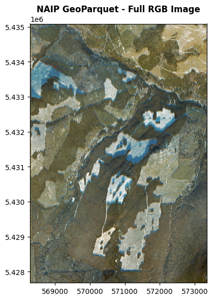
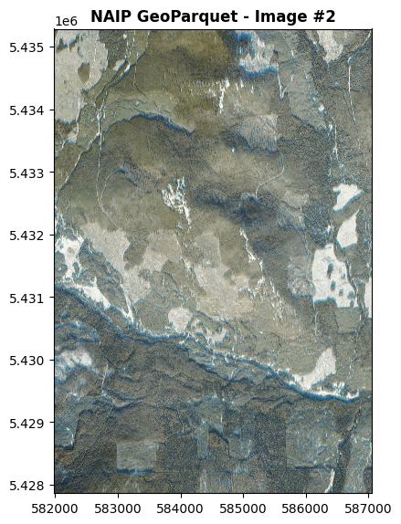
import mlcroissant as mlc
import rasterio
from rasterio.plot import show
import matplotlib.pyplot as plt
from itertools import islice

image_index = 1   # 0 = first image, 1 = second image, 2 = third image...

# 1. Load dataset
dataset = mlc.Dataset('naip_croissant.json')
records = dataset.records('naip_items')

# 2. Get the desired record safely
record = next(islice(records, image_index, None))

# 3. Extract URL
image_url = record['naip_items/image_url']
if isinstance(image_url, bytes):
    image_url = image_url.decode('utf-8')

# 4. Visualize
with rasterio.open(f"/vsicurl/{image_url}") as src:
    fig, ax = plt.subplots(figsize=(6, 6))
    show(src, ax=ax, title=f"NAIP GeoParquet - Image #{image_index + 1}")
    plt.tight_layout()
    plt.show()